An add-on for AUTOCAD, for the triangulation of a set of POINTS, isolines, DWG drawing to Google Earth, the volume and center of gravity of a set of bodies or between surfaces composed of 3DFACE. You can load a file of points having the format: Number X Y Z Code. You can make cross sections, longitudinal profile and color-filled contour map.
www.CADUTILS.com - more CAD for you!
Tags
3d pdf
3d to 2d
architecture
attributes
axis
balusters
bolts
cad to excel
cad tools
calculations
car park
concrete
converter
countor lines
cross sections
curves to arcs
curves to lines
dgn to dwg
dwg recovery
dwg to pdf
dwg to raster
excel to cad
fdo to kml
garden
google earth to cad
hatches
inserts points
isolines
path analysis
pdf
pdf to autocad
pdf to dwg
piping
plot
raster to vector
roads
sheet metal
signs
spatial
splines to polylines
stairs
steel shapes
svg to dxf
terrain
text to curves
total length
triangulation
unfold
vehicle simulation
weld
Topography in AutoCAD Featured
Last modified on Friday, 04 March 2016 11:25
Additional Info
- Features:
The triangulation is performed on a convex hull of a set of points.
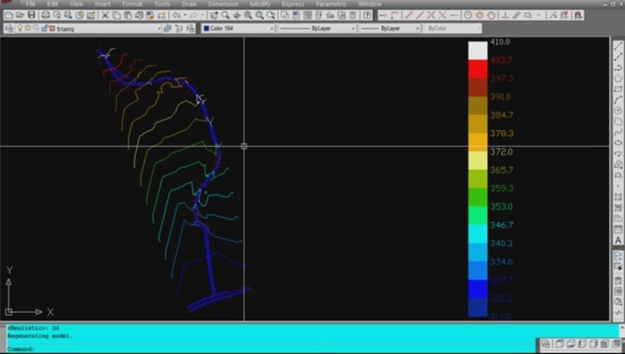
The isolines can be interpolated and their colors are according to a drawn legend. You can define a clipping parallelepiped for isolines.
You can load and draw a XYZ file of points having the format: Number X Y Z Code.
You can also make the projection over a triangulation of a 2D POLYLINE and generate cross sections and a longitudinal profile corresponding at projection.
Color-filled contour maps can be also generated.
You can draw a DWG file in Google Earth, by generating a KML file type.
- Publisher: RCAD SOFTWARE SRL
- Publisher web site: rcad.eu/triangulation-autocad
- Operating Systems: Windows
- CAD Requirements: AUTOCAD 2002 to 2016
- Other Requirements: -
- License types: Shareware
- Price: $ 69
- Online eShop: Buy Now at ShareIt store
- Download link: a_triang.zip
Tagged under:
Published in: AutoCAD Utilities
Media
Note: Online eshop links lead to the online stores managed by the relevant producer.
CAD System
Category
