www.CADUTILS.com - more CAD for you!                     

RTOPO - CAD for topography Featured

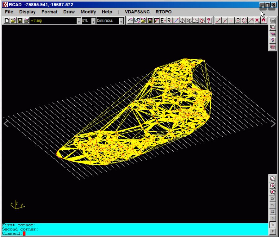
RTOPO - CAD for Topography, editing 3D points, triangulation, isolines, sections.

Together with RTOPO, is distributed the RCAD CAD system. It provides OpenGL real-time orbit, pan, zoom, shading, lighting and motion path animation. RCAD is similar with other popular CAD systems and can load and save DXF files. It has entries in the command text area, graphics area, menus and toolbars. It has commands for drawing and modification. RCAD can also run scripts and can be called from other programs.

Last modified on Friday, 04 March 2016 11:24

Additional Info

  • Features:


    Through its own CAD system (called RCAD), specialized for 3D and for a large number of entities, you can:

    • Load and draw a XYZ file of points having the format: Number X Y Z Code; the drawing is made by POINT, 3DPOLY, SPLINE or BLOCK entities, according to a modifiable library of codes,
    • Edit interactively the points (modify, delete or add); you can modify the coordinates, the code and the position (in 3DPOLY or SPLINE),
    • Triangulate the points on a convex hull or between an external contour and possibly more interior contours; “3dpoly” and “spline” RTOPO entities are actually break lines for triangulation; RTOPO has now a fast triangulation (millions of points in a few minutes),
    • Do isolines (contour lines) and color-filled contour map,
    • Do cross sections and longitudinal profile,
    • Achieve the interface files with the MicroPiste Setra  program, for road design
    • Draw watersides in sections,
    • Do the projection of several PLine entities over a triangulation,
    • Do the conversion of a triangulation to a regular grid of points,
    • Do the conversion of the existing isolines resulting from maps in points and then in a triangulation,
    • Represent the geological stratification resulting from drilling,
    • Calculate 3D area, center of gravity and the volume of some bodies limited by 3DFACE entities, between two triangulations or between a triangulation and a plane (soil excavation, for example),
    • Intersect and divide two triangulations (or two sets of 3dmesh and 3dface entities) or a triangulation by a horizontal plane,
    • Interpolate a set of 3DFACE entities, using quartic triangular patches with G1 continuity,
    • Transform a drawing containing entities as PLine (3dpoly), Line, Block and Text, in points having codes and then in a triangulation,
    • Represent 4D points cloud: “x y z r g b”, “x y z s” or “x y z r g b s” formats; 4D data are plotted based on color or based on a scalar and a legend of colors
  • Publisher: RCAD SOFTWARE SRL
  • Operating Systems: Windows
  • CAD Requirements: -
  • Other Requirements: Graphic card with OpenGL hardware acceleration
  • License types: Shareware
  • Price: $ 89

More in this category:

Note: Online eshop links lead to the online stores managed by the relevant producer.

Go to top