www.CADUTILS.com - more CAD for you!                     

GlobalCAD Terrain Featured

Easily create accurate and intelligent site surveys and stunning 3D terrain models in seconds!

The essential tools in GlobalCAD Terrain make it easy to create accurate and intelligent site surveys and stunning 3D terrain models with a single mouse click!.

Working with site survey data forms a critical component of any project. Information can be presented as anything from 2D markers to points in 3D space or contours. GlobalCAD Terrain gives you the tools to generate 'intelligent' surveys, either by converting an existing drawing or starting from scratch. Move any intelligent survey point marker and its associated XYZ value automatically updates to suit the new location!

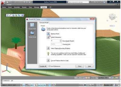
Furthermore, you can generate 3D surface terrain models covering vast areas with a single mouse click. The terrain is developed by connecting the given survey points and forming triangles to create a surface model. Using advanced algorithms, GlobalCAD Terrain can produce these models as polyface meshes or solids (including volumetric data).

The software is avaiable for AutoCAD and BricsCAD as well.

Last modified on Friday, 26 February 2016 14:54

Additional Info

  • Features:


    • Create surveys from scratch or instantly apply 'intelligent' markers to your existing survey points.
    • Convert almost any existing survey type such as 2D markers, blocks, points in 3D space, contour lines etc.
    • Move any markers in your drawing and their associated XYZ label automatically updates to reflect the new position!
    • Change the properties of intelligent markers to suit your company standards e.g. color, layer, text style etc.
    • Easily create impressive 3D surface terrains covering vast areas with one click. Ideal for visualization and land studies!
    • Using advanced algorithms, GlobalCAD Terrain can produce these models as a polyface mesh or solids.
    • Using polylines you can confine the terrain model to a given boundary line or isolate buildings and areas of water.
    • Conversion tools are available to instantly transform existing surface meshes to volumetric solid models.
  • Publisher: GlobalCAD Consultants Ltd.
  • Operating Systems: -
  • CAD Requirements: AutoCAD 2000-2016, BricsCAD Pro/Platinum V11-V16
  • License types: Trial/Commercial
  • Price: $ 149

Note: Online eshop links lead to the online stores managed by the relevant producer.

Go to top