www.CADUTILS.com - more CAD for you!                     

Spatial Manager™ for BricsCAD

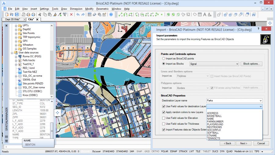
Spatial Manager™ for BricsCAD is a powerful BricsCAD plug-in designed for BricsCAD users who need to import, export and manage spatial data in a simple, fast and inexpensive way, which includes many possibilities not seen so far in BricsCAD. It comes in a lightweight application that runs inside BricsCAD and allows the user to import and export geospatial data between BricsCAD drawings and geospatial files, data servers or data stores.

It enables:

  • Import into BricsCAD from Google Earth (KML or KMZ), OpenStreetMap (OSM or PBF), Shapefiles (SHP), Geography Markup Language (GML), GPS, Points (many formats), Excel, Access, ESRI ArcInfo, MapInfo, PostGIS, SQL Server, SQLite, and many more geospatial sources
  • Export from BricsCAD to Google Earth (KML or KMZ), Shapefiles (SHP), Points (many formats), MapInfo, PostGIS, SQL Server, SQLite, and many more geospatial targets
  • Transformation of coordinates optional
  • Manage alphanumeric data tables as BricsCAD Extended Entity Data (EED). Viewer included
  • Save Tasks to replay the import processes so many times as desired

Spatial Manager for BricsCAD Editions: Basic, Standard, Professional

Last modified on Monday, 29 February 2016 09:11

Additional Info

  • Features:


    General

    • Import spatial data in BricsCAD drawings - All editions
    • Transformation of coordinates - All editions
    • Extended Entity Data (EED) viewer palette - Standard and Professional edition
    • Export spatial data from BricsCAD drawings - Professional edition only
    • Powerful and Easy to use Background Maps
    • Data Structure Management and Direct Data Edition
    • Labeling objects while importing
    • UK Ordnance Survey data compatibility

    Import processes

    • Entities imported into a new or open drawing - All editions
    • Basic target layer or new target layers using a field value - All editions
    • Use blocks for points and centroids - All editions
    • Block insertion parameters from field values - All editions
    • Polygon fills - All editions
    • Polygon centroids - All editions
    • MPolygon objects (even on basic AutoCAD) - All editions
    • Elevation and thickness from field values - All editions
    • Import data from tables as Extended Entity Data (EED) - Standard and Professional edition
    • Import tasks - Professional edition only

    Export processes - Professional edition only

    • Objects exported to geospatial files or servers
    • Select the objects to be exported
    • Option to treat the closed polylines as polygons
    • Automatic complex geometric operations
    • Filtering of incompatible objects

    Data sources

    • Manage your own shortcuts - All editions
    • Access to spatial data files (SHP, GPX, KML, OSM, GML, etc) - All editions
    • Manage your User data sources - Standard and Professional edition
    • Access to spatial database servers (SQL Server, PostGIS, etc) - Standard and Professional edition
    • Access to other connections (WFS, ODBC, etc.) - Standard and Professional edition
    • Manage schemas and tables - Standard and Professional edition
  • Publisher: Opencartis
  • Operating Systems: Windows 10, 8.1, 7,Vista SP1, XP SP3, Windows Server 2003 SP2, 2008 R2, 2008
  • CAD Requirements: BricsCAD Pro and Platinum, Versions: 13 - 16
  • Other Requirements: -
  • License types: Trial/Commercial
  • Price: $129 / $229 / $299

More in this category:

Media

Spatial Manager™ for BricsCAD: first preview

Note: Online eshop links lead to the online stores managed by the relevant producer.

Go to top