www.CADUTILS.com - more CAD for you!                     

Spatial Manager Desktop™

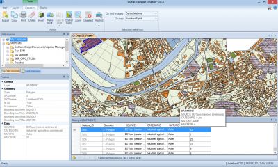
Spatial Manager Desktop™ is a desktop application designed to manage spatial data in a simple, fast and inexpensive way.

It enables: read and write spatial data using a wide range of file formats and spatial servers, Transform geometries between CRSs, Easily create and print maps, Use Tasks to automate any import and export process, Interface simple, intuitive and productive, Lightweight, easy and powerful

Spatial Manager Desktop™ will calculate geometric transformations of the features in line with the import or export processes, which will depend on the chosen Coordinate Reference System (CRS) for the source and target data.

Spatial Manager Desktop™ incorporates the UDS technology to easily connect with spatial database servers, or data stores, and also as the way the user can define the path to a particular spatial data file, including their own connection parameters.

Spatial Manager Desktop™ tasks are the way the user can save any import or export process and its parameters in order to run repetitive processes for import or export data tables.

Spatial Manager Desktop Editions: Basic, Standard, Professional

Last modified on Monday, 29 February 2016 09:09

Additional Info

  • Features:


    General features:

    • Quickly stylize and manage maps - All editions
    • Drag and drop spatial data to the maps - All editions
    • Background base maps (roads, satellite, hybrid) - All editions
    • Smart systems for map opening - All editions
    • Select and filter spatial features - All editions
    • Alphanumeric queries - All editions
    • Transformation of coordinates - All editions
    • Export information to use in office or CAD apps. - All editions
    • Printing of maps or selected features - All editions
    • Properties panel viewer - All editions
    • Query your spatial data - Professional & Standard Edition

    Layer management (All editions) :

    • Make new layers from selections or queries
    • Project layers in maps
    • Separate layers into new layers
    • External and internal layers - All edition
    • Disconnect layers from external sources
    • Copy features to layers

    Data sources :

    • Manage your own shortcuts - All editions
    • Access to spatial data files (SHP, GPX, KML, OSM, GML, etc) - All editions
    • Manage your User data sources - All edition - Professional & Standard Edition
    • Access to spatial database servers (SQL Server, PostGIS, etc) - Professional & Standard Edition
    • Access to other connections (WFS, ODBC, etc.) - Professional & Standard Edition

    Edition (Professional & Standard Edition only):

    • Find and replace data
    • Edit alphanumeric data
    • Multiple data edition
    • Remove unwanted features
    • Save modified layers or new layers

    Task & Processes :

    • Import and export processes - All editions
    • Automate processes using tasks - Professional Edition only
    • Run tasks in the OS Command window - Professional Edition only
  • Publisher: Opencartis
  • Operating Systems: Windows 10, 8.1, 7,Vista SP1, XP SP3, Windows Server 2003 SP2, 2008 R2, 2008
  • CAD Requirements: -
  • Other Requirements: -
  • License types: Trial/Commercial
  • Price: $199 / $349 /$599

More in this category:

Media

Spatial Manager Desktop - Demo

Note: Online eshop links lead to the online stores managed by the relevant producer.

Go to top